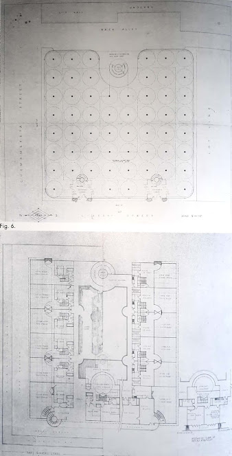
Site plan analysis
2D picture of the site


Vegetation:
The site is located on the northern slope of Jebel Toubkal, the highest mountain in North Africa. It includes a permanent watercourse, the Réghaya wadi, and further upstream, a fast-flowing freshwater mountain stream, Assif n'Aît Mizane, both classified among sites of biological interest and ecological of Morocco.
The vegetation cover varies as one descends, from forested steppes on mountainous shales to dense forest and Mediterranean scrub overlooking the lower reaches. The rocky course of the river is home to aquatic and shoreline plants, cultivated terraces, and countless orchards. (Ministere de la transition énergétique et du développement durable, 1996)
Geology
The High Atlas of Marrakech is part of the
intracontinental chain of the High Atlas, the most important morphological
element in Morocco. Its altitude is generally higher in its central and western
parts than in its eastern part. It separates the Atlantic plateaus and plains,
to the north and west, and the Saharan and anti-Atlas domain, to the south and
southeast. This chain constitutes a mountainous barrier much longer than it is
wide (800 km long / 40 to 80 km wide). Geographers have distinguished three comparable
parts; the Western High Atlas, the Central High Atlas, and the Eastern High
Atlas (Michard, 1976; Michard et al., 2008).
The High Atlas of Marrakech is an integral
part of the Western High Atlas, it includes the highest point of Morocco and
North Africa (4167 m at Jbel Toubkal). It is from these high altitudes that the
large wadis of the northern slope of the Marrakech region arise: the N’Fis,
Rdat, Zat, Ourika, and Rhéraia wadis.
This Alpine
intracontinental belt formed during Cenozoic times as a response to crustal
shortening. It exhibits abundant Paleozoic and Precambrian rocks which outcrop
continuously along its axis. On its eastern and northern flanks, Precambrian and
Paleozoic rocks are unconformably overlain by Mesozoic‐Cenozoic succession (Triassic
and Lower to Middle Jurassic formations). The pre‐Mesozoic basement is exposed
in several inliers of the High Atlas, forming the most elevated areas of the
Western High Atlas. The Precambrian basement is composed of metamorphic rocks
and granitoids. The Paleozoic succession ranges from Lower Cambrian to
Carboniferous and is mostly characterized by deformed clastic rocks. The
Mesozoic succession of the High Atlas belt started with the Late
Permian‐Triassic red beds (conglomerates, sandstones, siltstones, and
mudstones), unconformably resting on the Lower Paleozoic rocks or on the
Precambrian basement. These continental deposits (Fabuel‐Perez et al., 2009)
represent the detrital infilling of basins developed during the Late
Permian‐Triassic Atlasic pre‐rifting phase. The pre‐rift deposits are capped by
basalt that provides absolute ages of about 200 Ma corresponding to the
Triassic‐Jurassic transition (Marzoli et al, 2004). The overlying limestones and dolomites represent the
transgressive Lower Liassic platform. The Upper Liassic‐Lower Dogger (from
Toarcian to Bajocian) are varicolored marls and reefal limestones underlying
Bathonian red sandstones and silty shales (Ellouz et al., 2003). The Cretaceous
is characterized by red sandstones and conglomerates (Gauthier, 1957) evolving
to platform white limestones of the Cenomanian‐Turonian age. During the Upper
Cretaceous‐Paleogene, the sedimentation is mainly continental and lacustrine
with minor marine bioclastic limestones of Eocene age (Marzoqi and Pascal,
2000). The Neogene continental deposits, occurring above a regional
unconformity, resulted essentially from the syn-deformation erosion of the
mountain belt (Miocene‐Pliocene molasses). The post‐Jurassic deposits have been
largely eroded into the High Atlas being preserved only in a few limited
outcrops.
The Ourika, Rheraia, and N'Fis watersheds are developed on two major geological formations: the
Precambrian metamorphic intrusive rocks and the Paleozoic sedimentary
formations. Minor outcrops of Triassic siltstones, and Mesozoic calcareous and
marlaceous cover are also observed in the downstream parts of the watersheds.

Our Riad setup area is located in a narrow, rugged part of the range. The river networks developed on the northern slopes of the High Atlas Mountains present asymmetrical watersheds. The right bank of the main river (Rheraia) crossing the village of Imlil is more developed (68%). The rocky materials encountered in this area date mainly from the Precambrian, Primary, and Permo-Triassic. The Precambrian, in the Horst of Rheraia, is essentially made up of eruptive terrains whose granite constitutes the bedrock of all the red sandstone plateaus. The latter appears, intermixed with lavas (Andesites). The sedimentary formations of the primary era are made up of limestone at the base, topped with quartzites and especially green and gray shales. The beautiful Imlil valley shows an excellent stratigraphic section, going from the Triassic to the Precambrian of Toubkal, and crossed by the large faults of the axial zone of the Precambrian block (Sidi Fars fault, Tizi Oussem Fault…). At the level of this valley, the ante-permotriassic surface was fossilized under a very thick cover of detrital deposits. It is essentially composed of conglomerates and sandstones topped by immense flows of doleritic basalts. The dominant Cretaceous structures are in reversed series, overlapped by Precambrian sections. Paleozoic and Triassic geostructures infiltrated by a fault-dominated Tahannaout and crossed by the Rheraia river.

Climate:

- Ministere de la transition énergétique et du développement durable, (1996) Plan Directeur des Aires protégées du Maroc SIBE CONTINENTAUX/Vol.2.
- Delcaillau, B. Laville, E. Amhrar, M. Namous, M. Dugué, O. Pedoja, K. (2010) Quaternary evolution of the Marrakech High Atlas and morphotectonic evidence of activity along the Tizi N’Test Fault, Morocco. Geomorphology, 118(3–4), pp. 262–279.
- Discover Limited. (2015) Rural Settlement in the High Atlas Mountains: A Case Study of the Ait Mizane Valley.
- Ellouz, N. Patriat, M. Gaulier, JM. Bouatmani, R. Saboundji, S. (2003) From rifting to Alpine inversion: Mesozoic and Cenozoic subsidence history of some Moroccan basins. Sedim. Geol. 156: 185–212.
- Fabuel‐Perez, I. Redfern, J. Hodgetts, D. (2009) Sedimentology of an intra‐montane riftcontrolled fluvial dominated succession: The Upper Triassic Oukaimeden Sandstone Formation, Central High Atlas, Morocco. Sedimentary Geol. 218: 103‐140.
- Gauthier, H. (1957) Contribution à l'étude géologique des terrains post liasiques des bassins du Dadès et du Haut Todra (Maroc méridional). Notes Memoires Service Géologique.
- Khatla, K. (2023) Reconstruction post-séisme : “Les spécificités des villages doivent être préservées” (experts) - Médias24. Médias24. https://medias24.com/2023/09/13/reconstruction-post-seisme-les-specificites-des-villages-doivent-etre-preservees-experts/
- Marzoli, A. Bertrand, H. Knight, KB. Cirilli, S. Buratti, N. Verati, C. Nomade, S. Renne, PR. Youbi, N. Martini, R. Allenbakh, K. Neuwerth, R. Rapaille, C. Zaninetti, L. Bellieni, G. (2004) Synchronism of the Central Atlantic magmatic province and the Triassic‐Jurassic boundary climatic and biotic crisis. Geology 32: 973‐976.
- Marzoqi, M. Pascal, A. (2000) Séquences de dépots et tectono‐eustatisme à la limite Crétacé/Tertiaire sur la marge sud‐téthysienne (Atlas de Marrakech et bassin de Ouarzazate, Maroc). Newsletter. Stratigr., 38: 57‐80.
- Michard, A. (1976) Éléments de géologie marocaine. Notes Mém. Serv. Géol. Maroc, vol. 252. 408 p.
- Michard, A. Hoepffner, C., Soulaimani, A. & Baidder, L. (2008) The Variscan Belt. In Michard, A., Saddiqi, O., Chalouan, A., Frizon de Lamotte, D. (Eds.), Continental Evolution: The Geology of Morocco, Springer Verl., 65-131.
Comments
Post a Comment